This update from NASA's Earth Observatory shows the progression of the fire from August 19 through September 2nd.
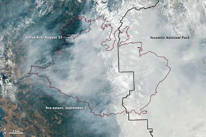
The second image is from the Landsat 8 satellite.
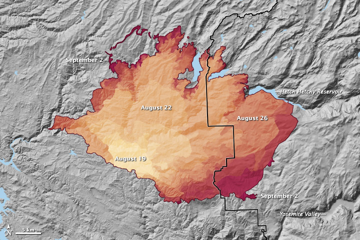 |
| Progression of California's Rim Fire |
 |
| Landsat 8 Image of California's Rim Fire |
|
| Progression of California's Rim Fire |
|
| Landsat 8 Image of California's Rim Fire |
No comments:
Post a Comment